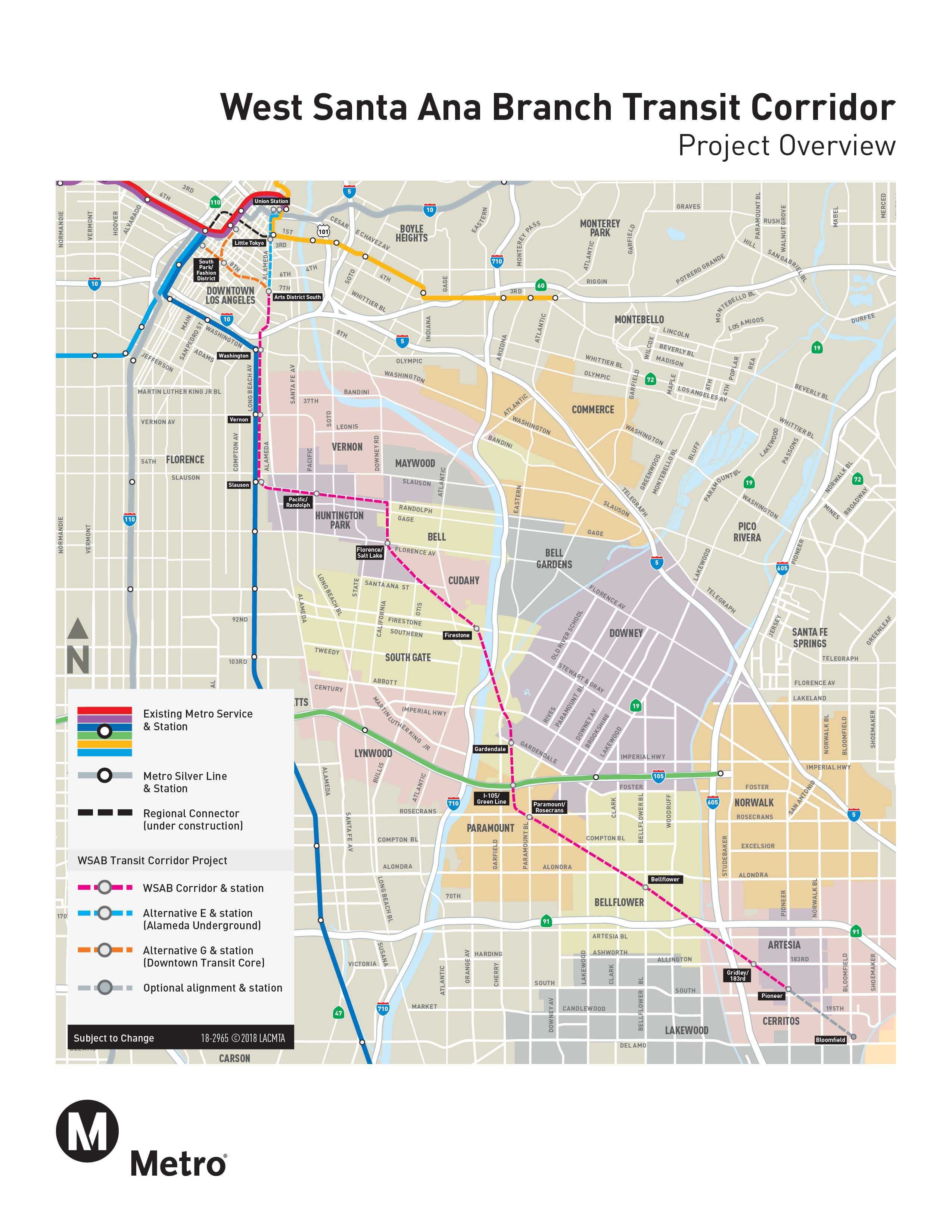
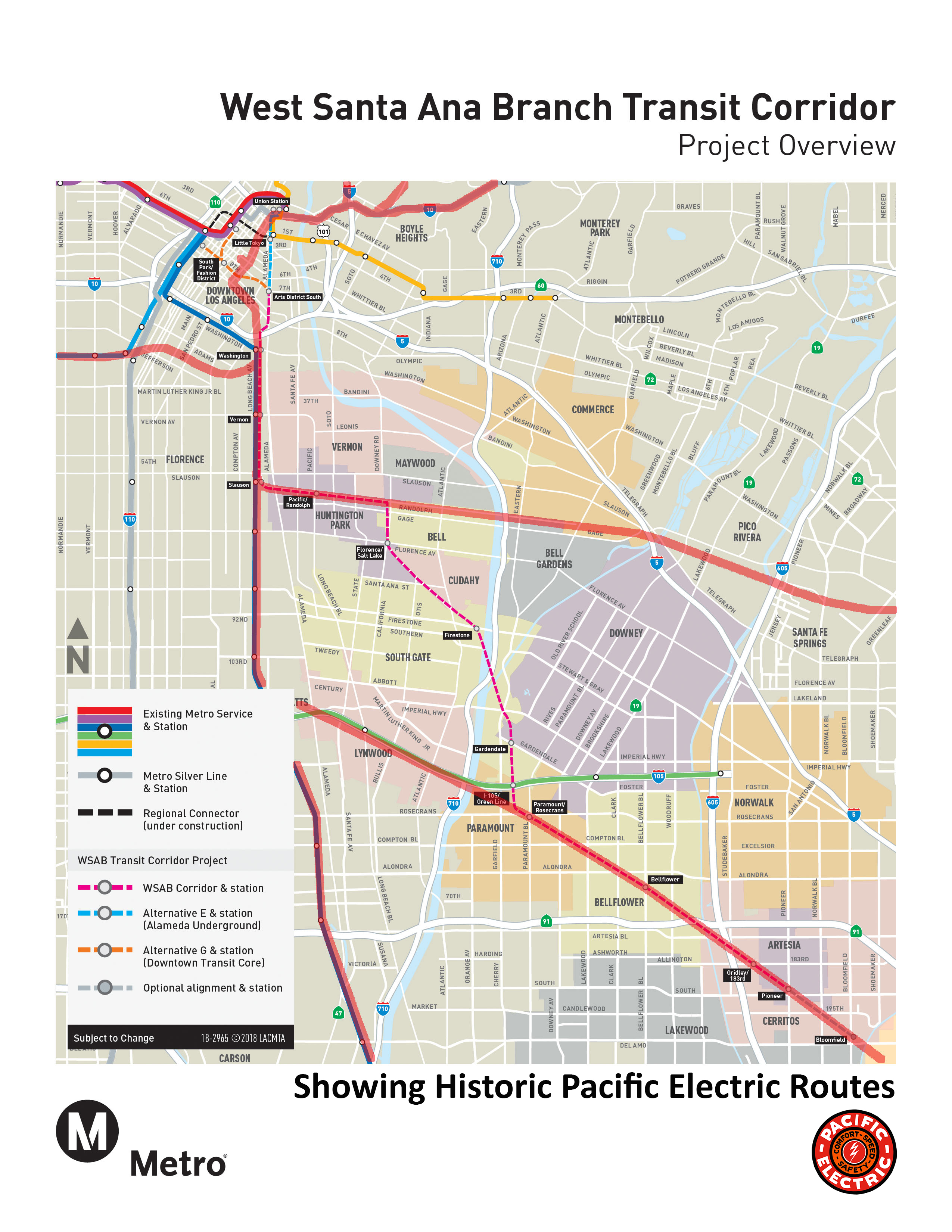
Metro West Santa Ana Branch Transit Corridor Map (June 2018)
A recently published map from Metro has been circulating around the web showing several proposed routes for the West Santa Ana Branch Transit Corridor.
We thought it would be interesting to compare the proposed new routing to the historic lines of the old Pacific Electric Railway.
Our thanks to Eriks Garsvo for the map overlay artwork.


Recent Posts
Comments


I have a question on the proposed Santa Ana Branch Metro map. Why don’t they just continue northwest from Paramount, through Lynwood and then join the L.A.-Long Beach Line at Watts? Wouldn’t that be simpler? Seems like they could share right of way for a stretch with the “Green” line thereby saving cost.
Regards,
Fred M. Cain